Western Australia
Pilbara exploration targeting using South Africa’s Witwatersrand as a template. (Part 11).
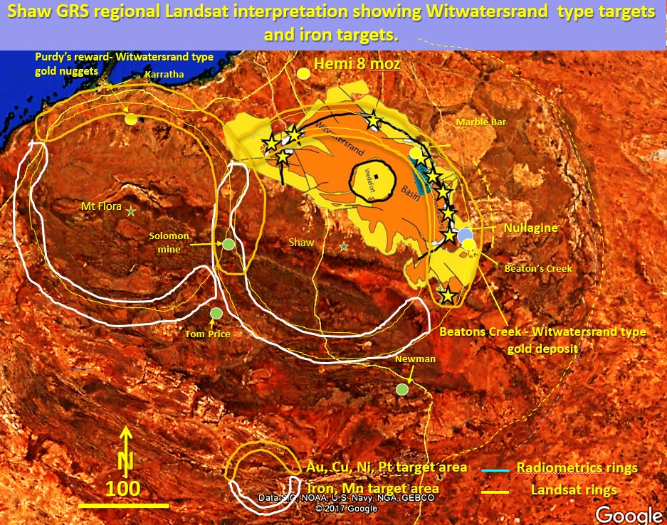
Figure 32 above. Shaw and Mt Flora ring structures, Witwatersrand type targets. There has been a lot of alluvial gold found on the unconformable Fortescue basin boundary recently. Why and … [Read More]
10. Pilbara Craton structural geology, mineralisation and Exploration Targeting. Western Australia. (Part 10).
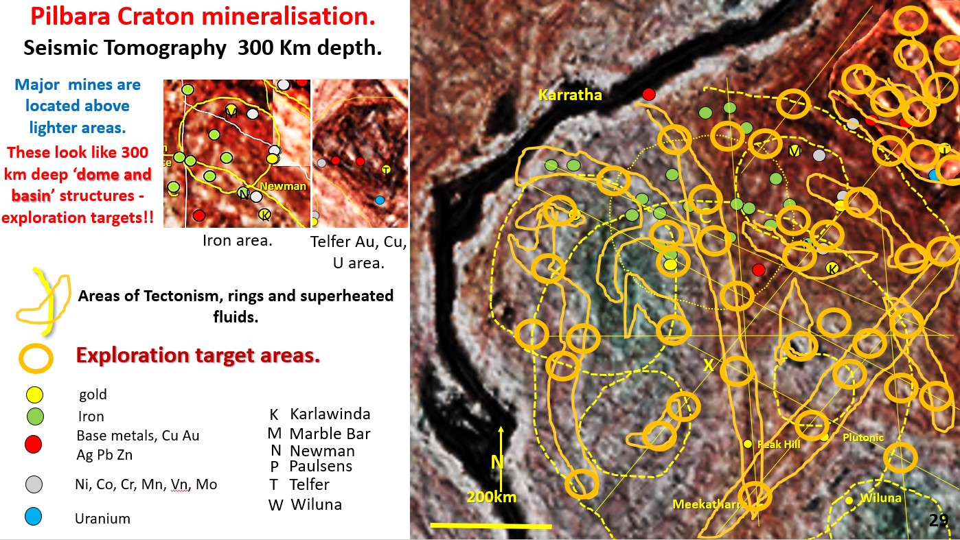
Figure 29 above. Pilbara Seismic tomography, 300 km depth. Geology and mineralisation, Exploration targeting based on maximum P/T gradient. This figure has had the high P/T boundaries marked out in … [Read More]