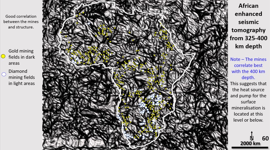
African ultra-detailed Seismic Tomography from 400 km depth with mines overlaid.

African Continent Evolution research using ultra-detailed Landsat and Seismic Tomography from surface to 2,900 km depth. (Part 9) African continent tomography at 400 km depth.

African Continent Evolution research using ultra-detailed Seismic Tomography from 400 km depth. Implications for Plate Tectonics, continent formation and the genesis and targeting of mineralisation.

Like it? Share it!
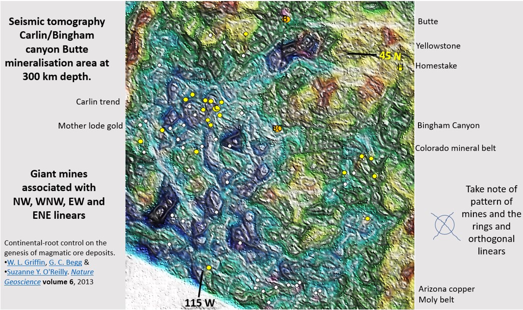
Carlin district ultra-detailed tomography at 300 km depth with mines overlaid.

Western Australian, Yilgarn Craton mineral mineral fields and the Carlin/Battle mountain/Butte/Bingham Canyon area in Western USA. Comparing exploration targeting in these fantastically mineralised areas with Africa (section 8).

Research of the tomography of the African continent at 300 km depth. In this section we will be looking at the Australian Yilgarn Craton mineral fields and the Carlin/Battle mountain/Butte/Bingham Canyon area in Western USA using tomography at 300 km depth. We will compare exploration targeting in these fantastically mineralised areas with Africa at 300 km depth seen in the previous section.

Like it? Share it!
EagleEye enhancement of the 3D magnetic inversion section through section 254 of the Magdala mine. Interpretation of D1 to D4 in Watchorn’s 1986 MSc thesis.

Stawell gold mining area; Mine Scale Exploration Targeting using EagleEye enhancement of magnetics in plan and 300 Magdala cross section

Magdala and Flat-Vertical mines’ structural geology. Stawell gold mining area; Mine Scale Exploration Targeting using EagleEye enhancement of magnetics in plan and 300 Magdala cross section.

Like it? Share it!