Australia

12. Gawler Craton mineralisation and exploration targeting using Seismic Tomography at 300 Km depth. (Part 13).
Figure 37. Gawler Craton mineralisation and exploration targeting. Seismic Tomography -300 Km depth. This section looks at exploration targeting in the Gawler Craton, South Australia. Are the controls similar to … [Read More]
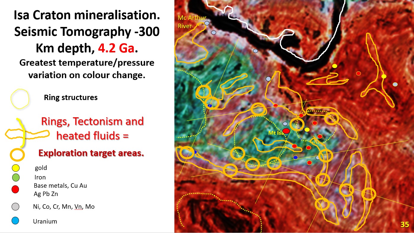
11. Exploration targeting – Mt Isa craton, using Landsat and Seismic tomography at 300 km depth. (Part12.)
Figure 35 above. Isa Craton mineralisation and targeting. Seismic Tomography -300 Km depth. Why are they specifically located here? What is special about the area that we can use for … [Read More]